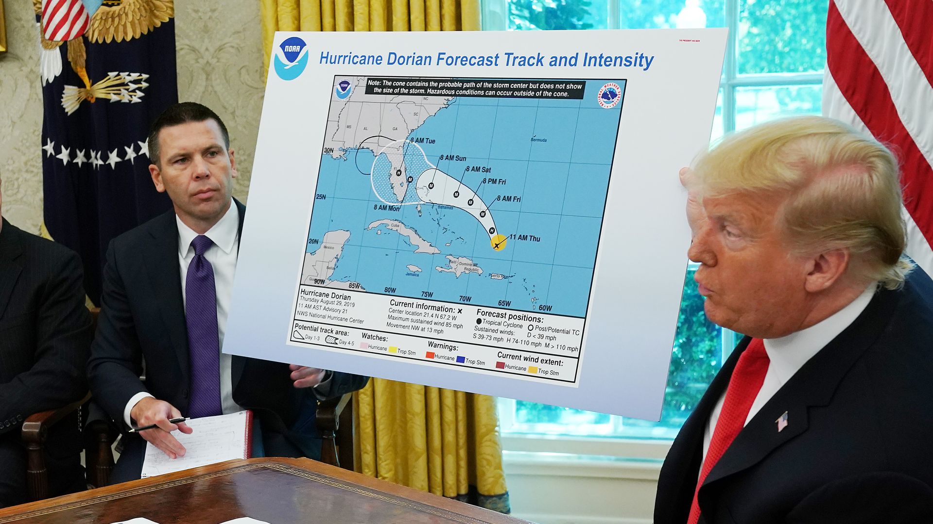
- Presumably, the loop was drawn on the map to make it appear as though Trump's false claim that Alabama was in the storm's path was true. (The National Weather Service has since debunked the claim.)
- In response, the White House provided a map it said Trump was shown on Sunday that displayed a large possible storm track that included a small piece of Alabama. It didn't say who produced the map.
- Trump also tweeted a map showing many possible storm tracks, including over Alabama. But the map was dated Aug. 28, days before the storm approached the coast.
The big picture: This isn't the first time Trump has pulled something like this.
- April 2019: Trump tweeted a doctored video of Nancy Pelosi that made her seem drunk with the caption "PELOSI STAMMERS THROUGH NEWS CONFERENCE."
- January 2019: Gizmodo reported that photos posted to Trump's official Facebook page seemed altered to make himself look thinner and his hands longer. Trump faced insults about his hand size during the 2016 Republican primaries, which he adamantly refuted.
- November 2018: Then-White House press secretary Sarah Sanders shared an edited video on Twitter of a confrontation between CNN's Jim Acosta and a White House press official that made Acosta look aggressive. The video appeared to editorialize the incident to justify the removal of Acosta's press pass.
The bottom line: The media has been focused on preparing for deepfakes, but amateur fakes coming from the White House are already happening.
This story has been updated to include the Trump tweet and the White House response.
https://www.axios.com/trump-map-dorian-doctors-media-video-a86efda7-ba6f-4989-a186-e39527824de8.html

